Flora of the Turnbull National Wildlife Refuge |
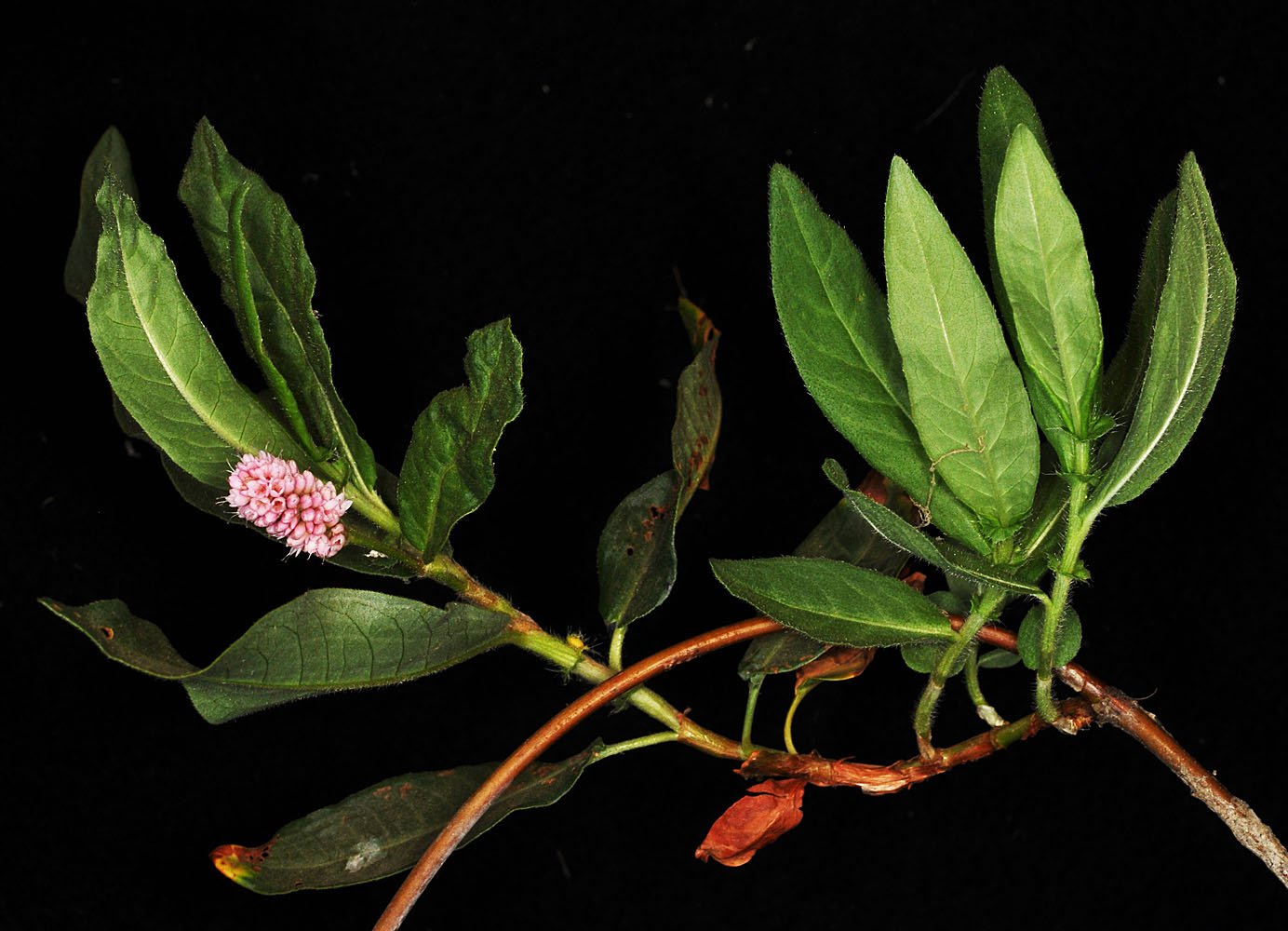
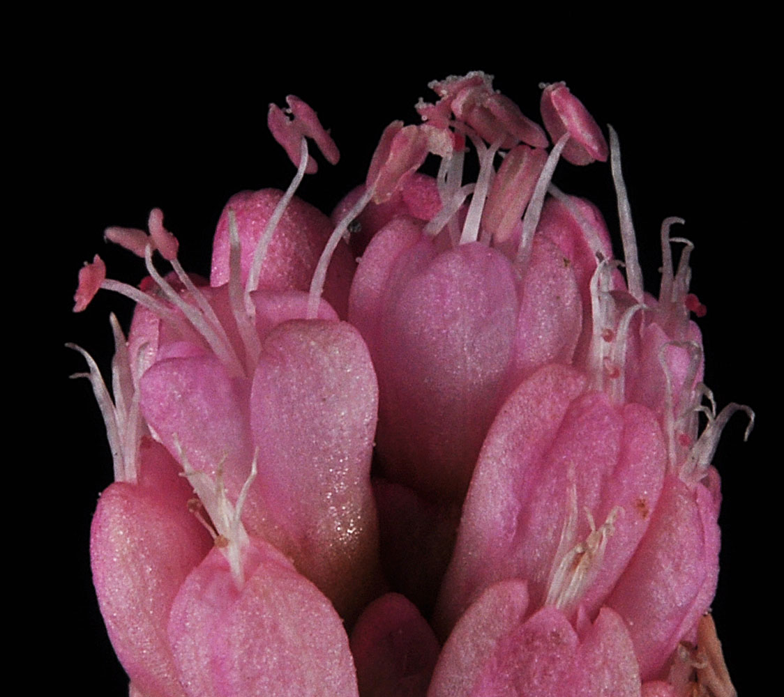
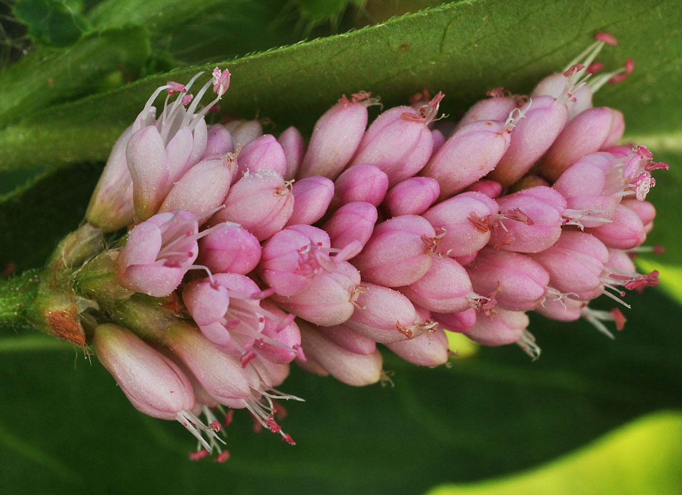
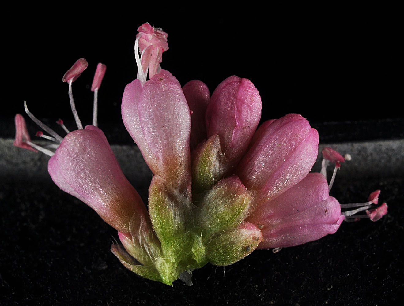
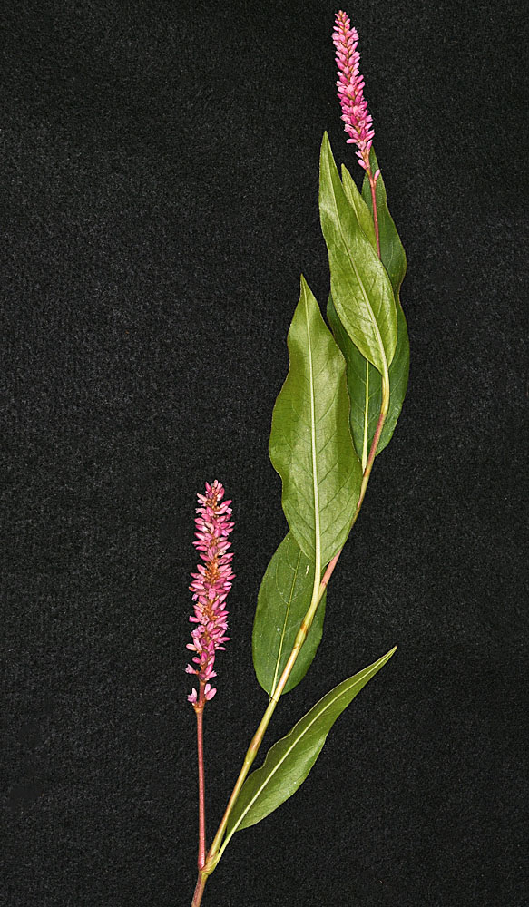
| Persicaria amphibia |
|
|
||
| Polygonaceae; Native |
| SYNONYMS |
Polygonum amphibium L.
Polygonum amphibium L. var. coccineum (Muhl. ex Willd.) Farw.
Polygonum amphibium L. var. emersum Michx.
Polygonum amphibium L. var. stipulaceum N. Coleman
Polygonum coccineum Muhl. ex Willd.
Polygonum natans Eaton
|
Unless otherwise noted the images are those of ©Robert L. Carr . Click on any image to load an enlargement
| Back to Main Page | Family Index | Genus Index |
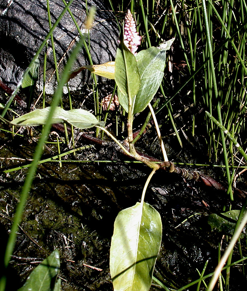
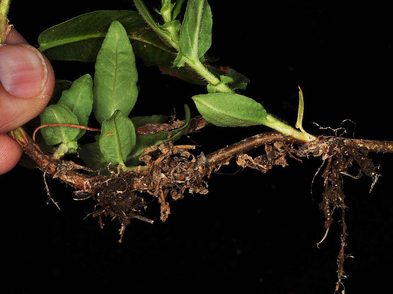
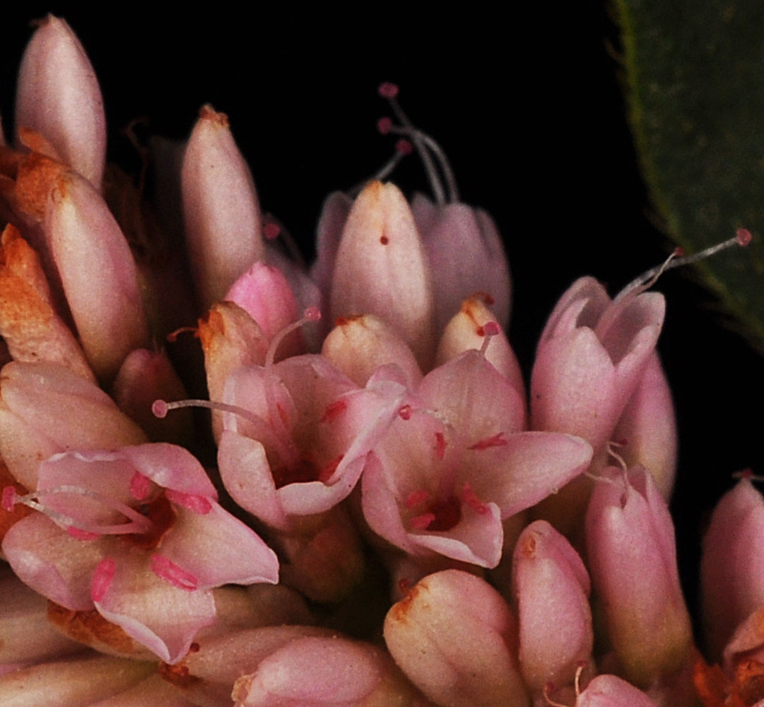
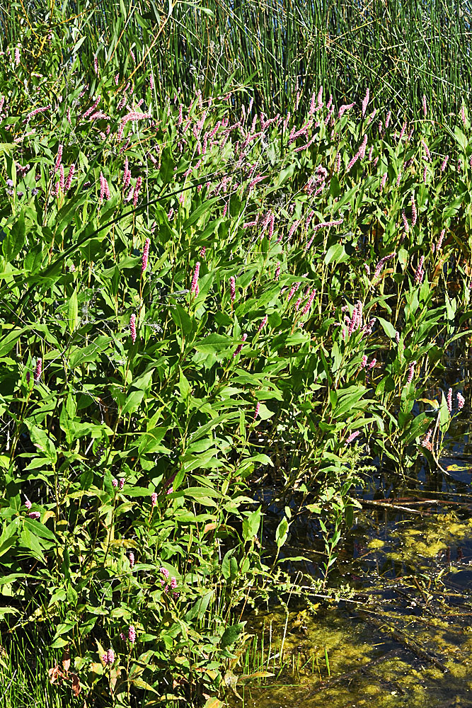
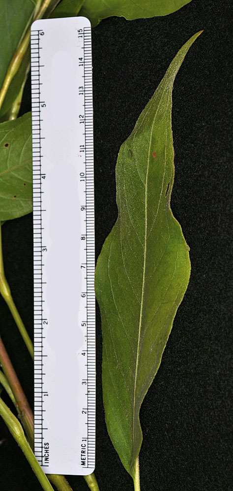
| S of Hwy 904 W of Cheney, WA, 0.2 mi E of Ritchey Rd N - Spokane Co. - 6/12/2005 | S of Hwy 904 W of Cheney, WA, 0.2 mi E of Ritchey Rd N - Spokane Co. - 6/12/2005 | S of Hwy 904 W of Cheney, WA, 0.2 mi E of Ritchey Rd N - Spokane Co. - 6/12/2005 | Along Sand Dunes Rd. ca. 1.75 mi. S of S. Frontage Rd. E.; S of w. edge of Moses Lake, WA; N 47.07195 W 119.34223; Grant Co.; 8/17/2012 |
|
|
|
|
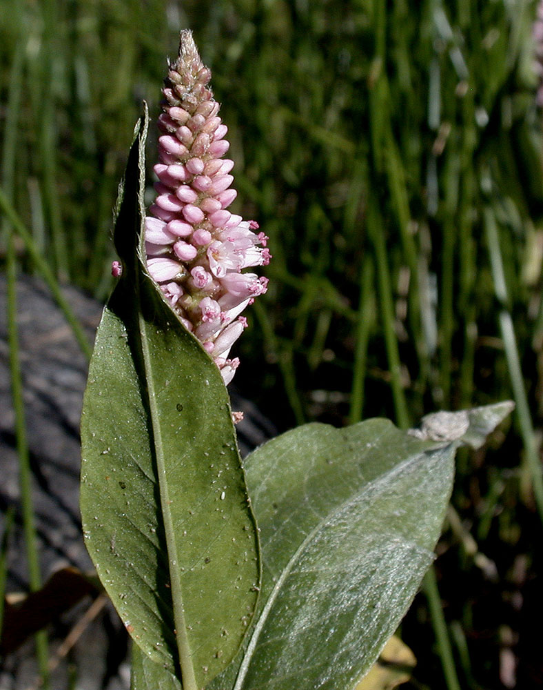
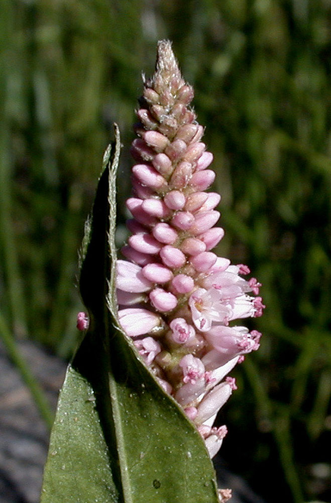
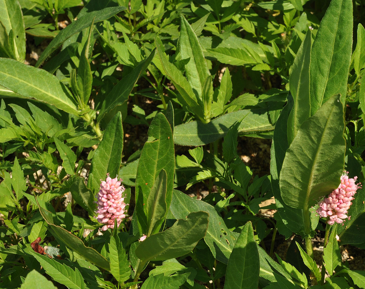
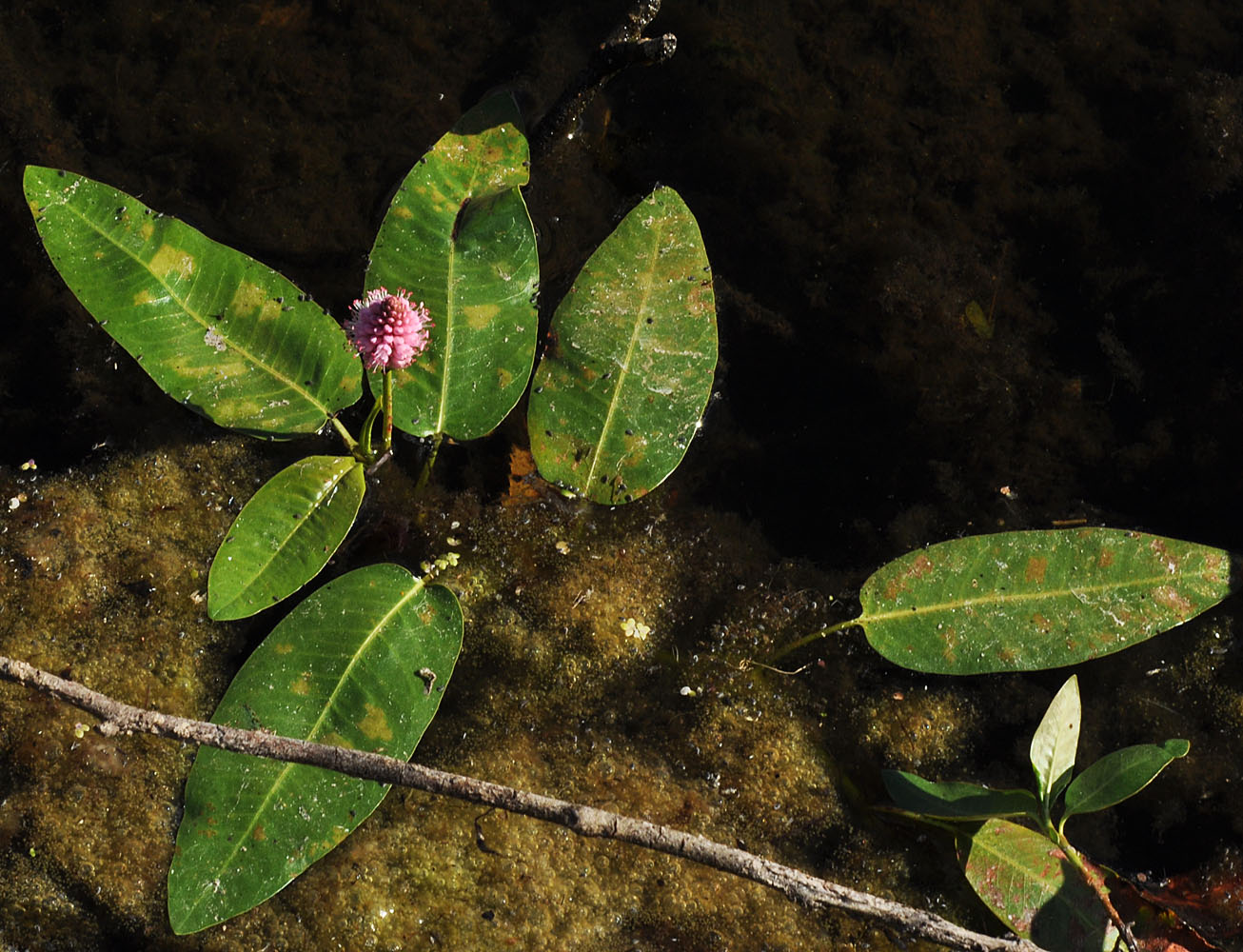
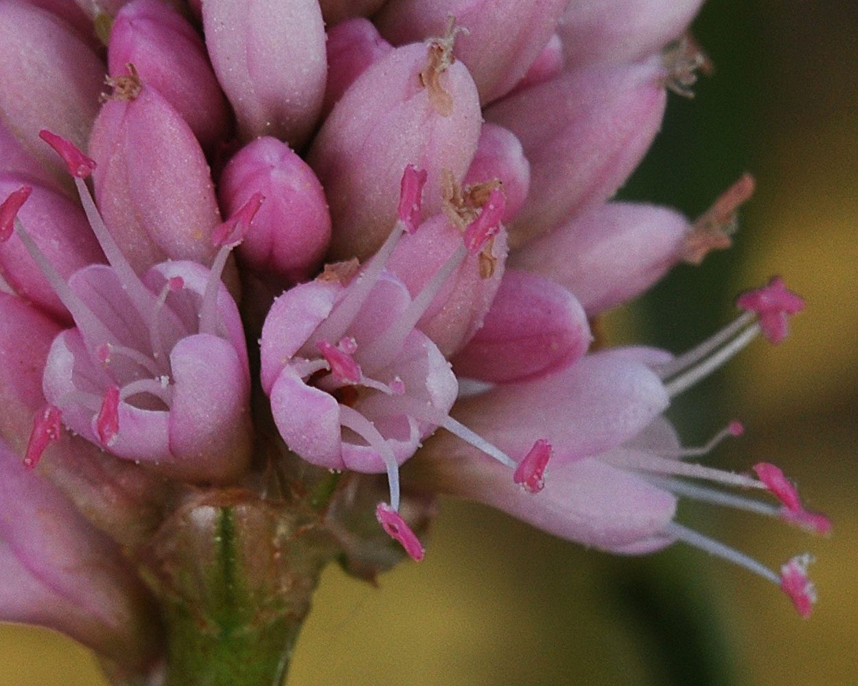
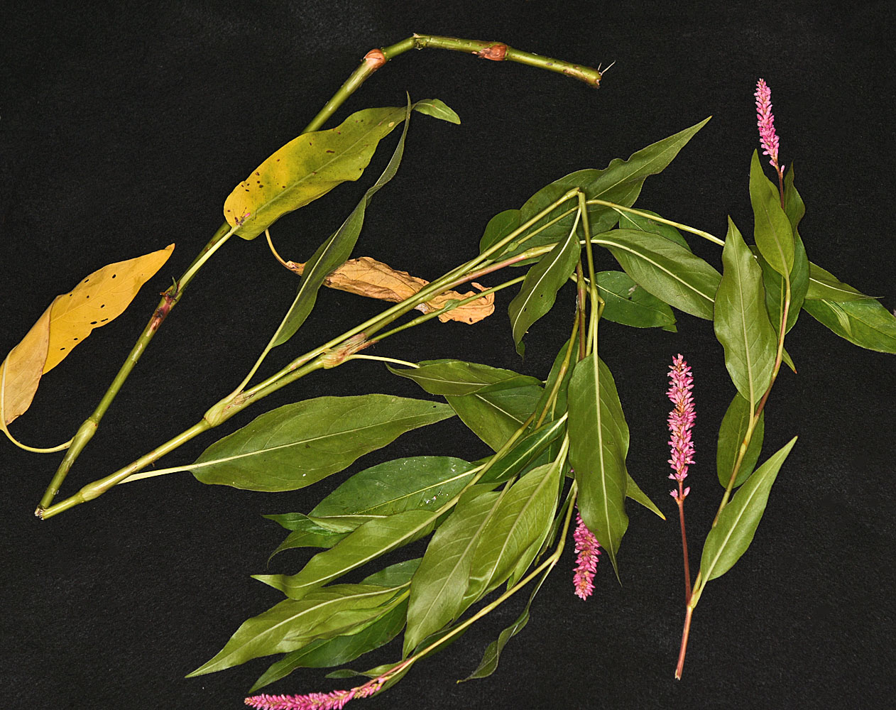
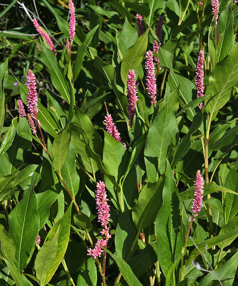
| Along Sand Dunes Rd. ca. 1.75 mi. S of S. Frontage Rd. E.; S of w. edge of Moses Lake, WA; N 47.07195 W 119.34223; Grant Co.; 8/17/2012 | Along Sand Dunes Rd. ca. 1.75 mi. S of S. Frontage Rd. E.; S of w. edge of Moses Lake, WA; N 47.07195 W 119.34223; Grant Co.; 8/17/2012 | North edge of Mcdowell Lake; ca. 10.5 air mi. SE of Colville, WA; N 48.46953 W 117.68309; Stevens Co.; 8/24/2012 | |
 |
 |
 |
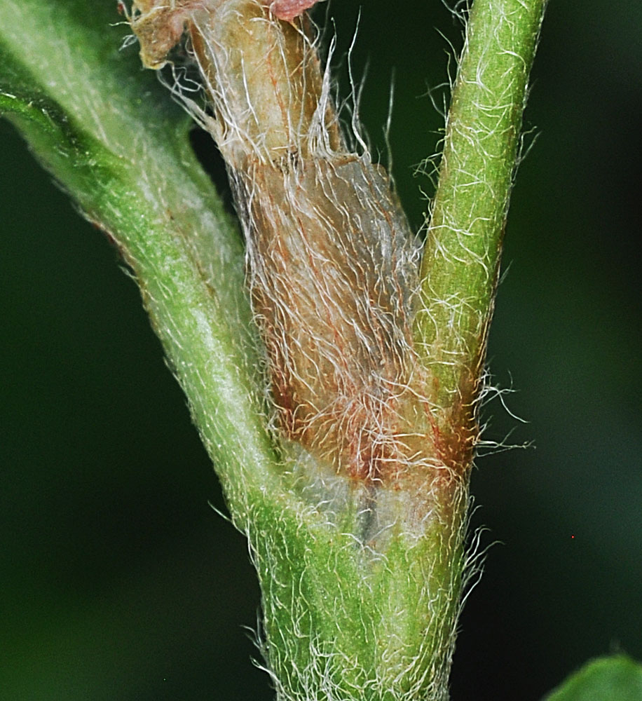
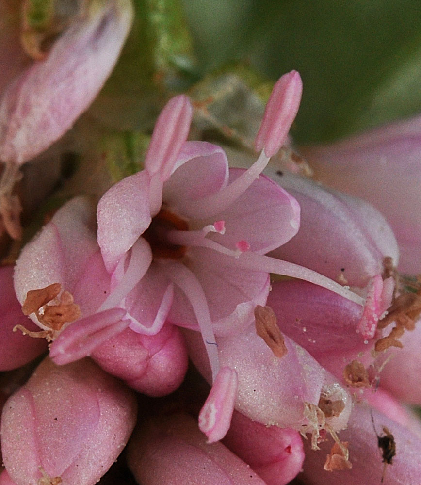
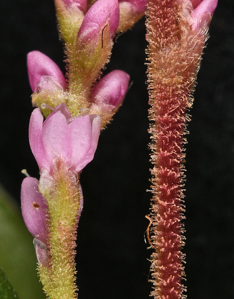
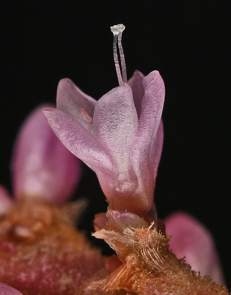
| Along Sand Dunes Rd. ca. 1.75 mi. S of S. Frontage Rd. E.; S of w. edge of Moses Lake, WA; N 47.07195 W 119.34223; Grant Co.; 8/17/2012 | Along Sand Dunes Rd. ca. 1.75 mi. S of S. Frontage Rd. E.; S of w. edge of Moses Lake, WA; N 47.07195 W 119.34223; Grant Co.; 8/17/2012 | Along Sand Dunes Rd. ca. 1.75 mi. S of S. Frontage Rd. E.; S of w. edge of Moses Lake, WA; N 47.07195 W 119.34223; Grant Co.; 8/19/2012 | |
 |
 |
 |
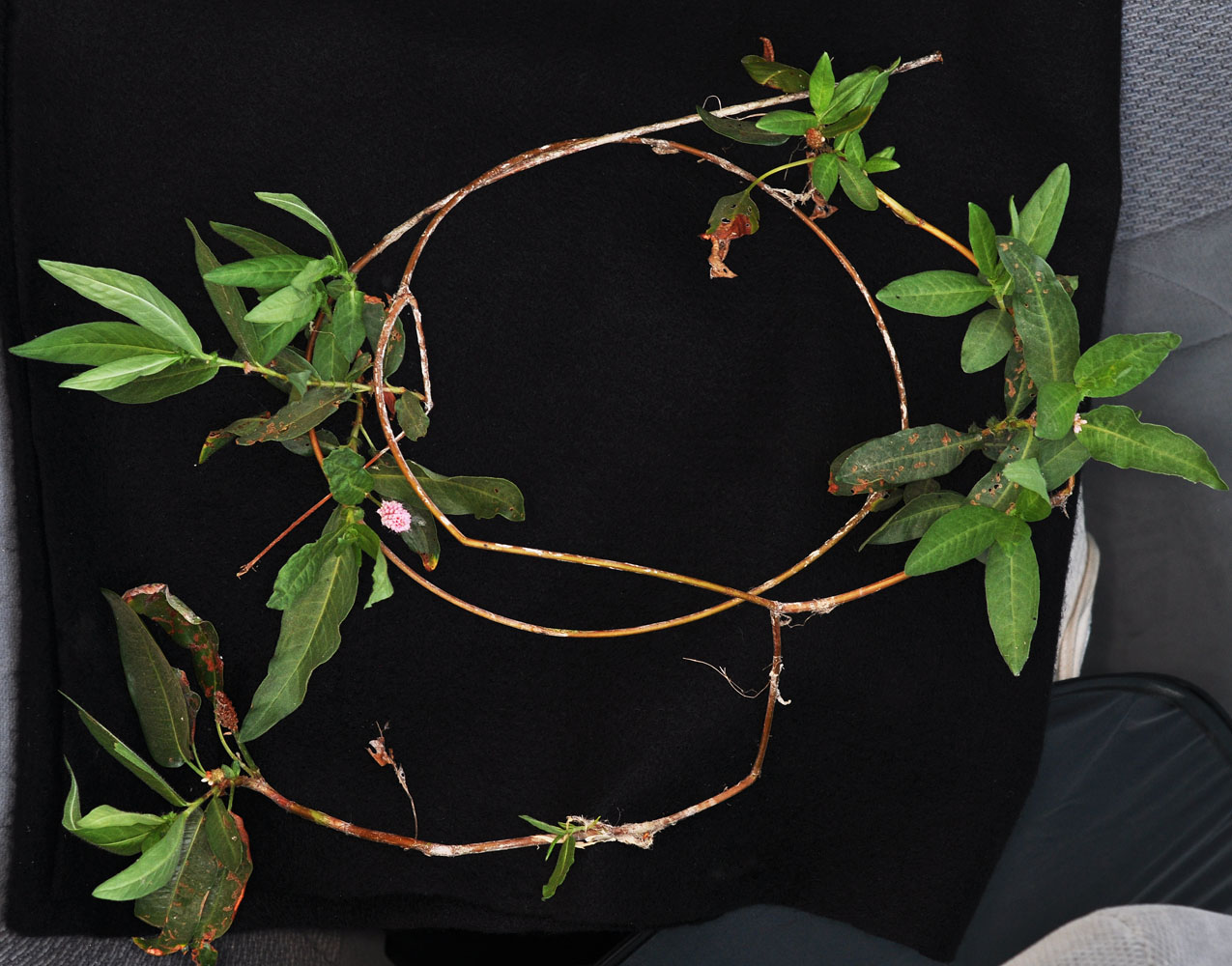
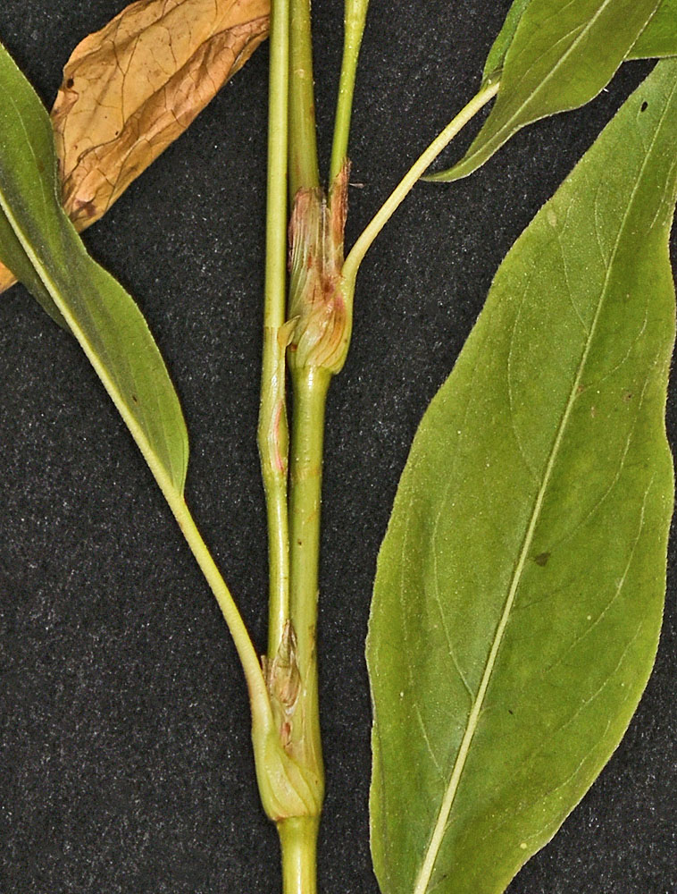
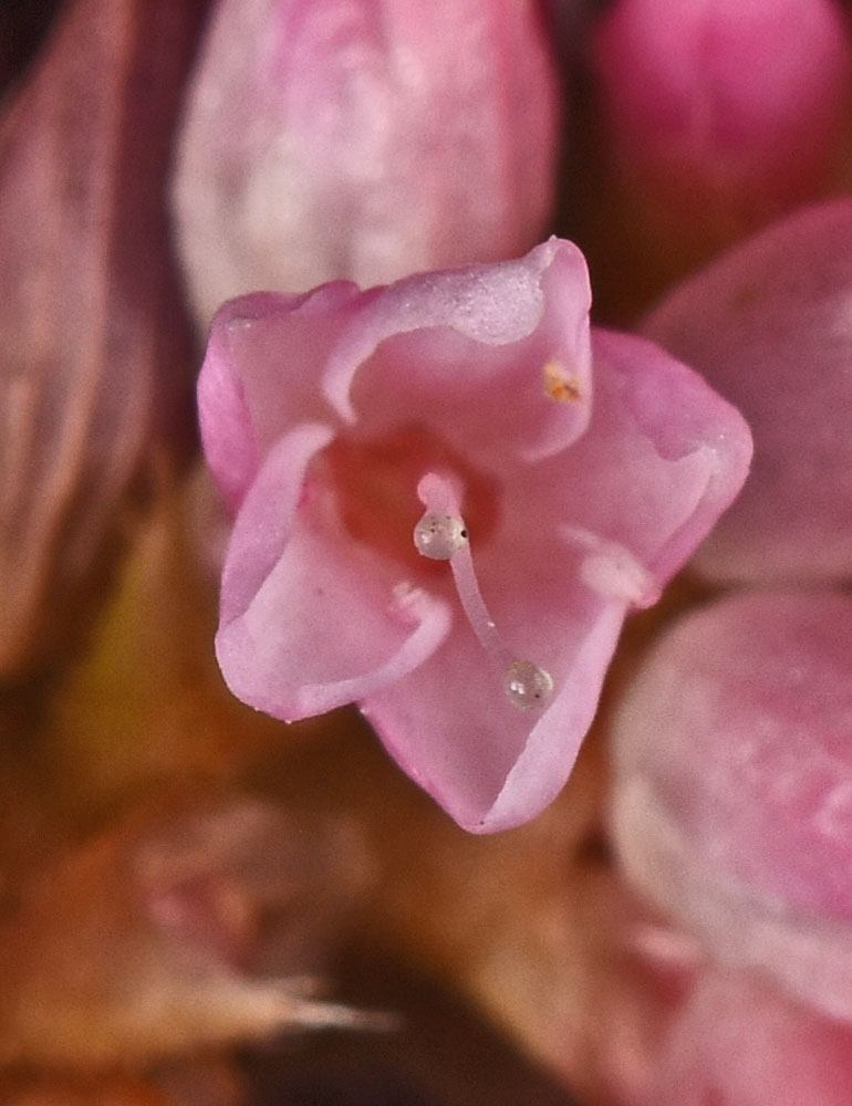
| Along Sand Dunes Rd. ca. 1.75 mi. S of S. Frontage Rd. E.; S of w. edge of Moses Lake, WA; N 47.07195 W 119.34223; Grant Co.; 8/17/2012 | Along Sand Dunes Rd. ca. 1.75 mi. S of S. Frontage Rd. E.; S of w. edge of Moses Lake, WA; N 47.07195 W 119.34223; Grant Co.; 8/19/2012 | ||
 |
 |
| Along Sand Dunes Rd. ca. 1.75 mi. S of S. Frontage Rd. E.; S of w. edge of Moses Lake, WA; N 47.07195 W 119.34223; Grant Co.; 8/17/2012 | North edge of Mcdowell Lake; ca. 10.5 air mi. SE of Colville, WA; N 48.46953 W 117.68309; Stevens Co.; 8/24/2012 | North edge of Mcdowell Lake; ca. 10.5 air mi. SE of Colville, WA; N 48.46953 W 117.68309; Stevens Co.; 8/24/2012 | |
 |
 |
 |
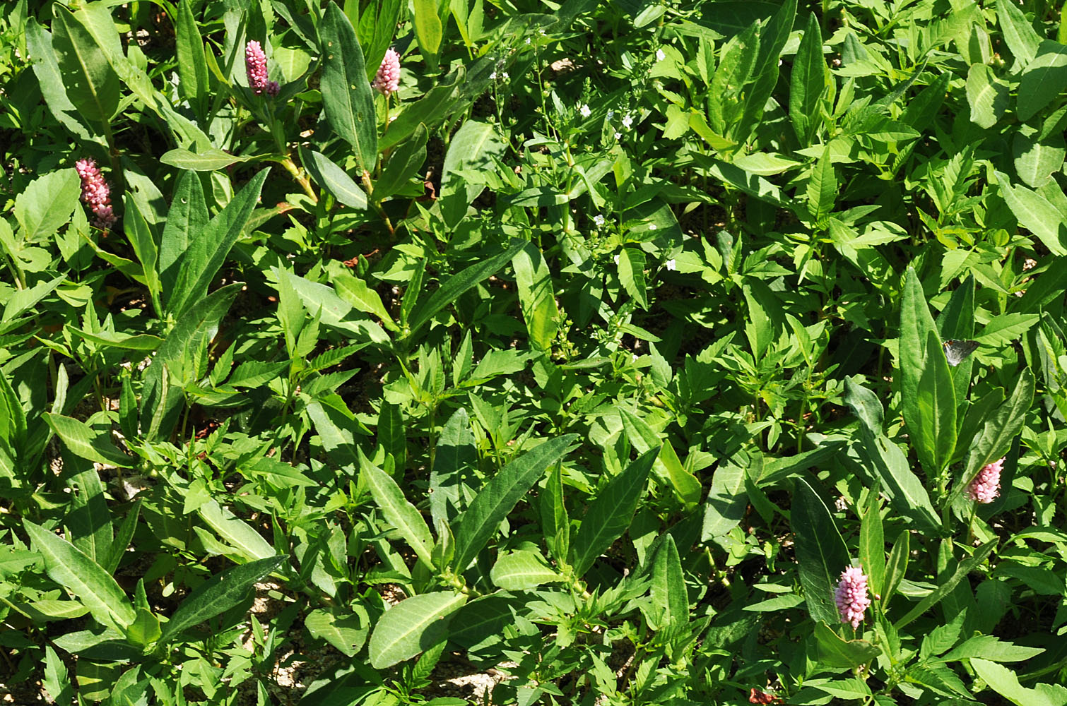
| Along Sand Dunes Rd. ca. 1.75 mi. S of S. Frontage Rd. E.; S of w. edge of Moses Lake, WA; N 47.07195 W 119.34223; Grant Co.; 8/17/2012 | Near boat ramp at N end of CoffeePot Lake; 17.9 air mi S of Creston, WA; N 47.50027 W 118.55563; Lincoln Co.; 7/30/2017 | Near boat ramp at N end of CoffeePot Lake; 17.9 air mi S of Creston, WA; N 47.50027 W 118.55563; Lincoln Co.; 7/30/2017 | |
 |
 |
 |
| Near boat ramp at N end of CoffeePot Lake; 17.9 air mi S of Creston, WA; N 47.50027 W 118.55563; Lincoln Co.; 7/30/2017 | Near boat ramp at N end of CoffeePot Lake; 17.9 air mi S of Creston, WA; N 47.50027 W 118.55563; Lincoln Co.; 7/30/2017 | Near boat ramp at N end of CoffeePot Lake; 17.9 air mi S of Creston, WA; N 47.50027 W 118.55563; Lincoln Co.; 7/30/2017 | Near boat ramp at N end of CoffeePot Lake; 17.9 air mi S of Creston, WA; N 47.50027 W 118.55563; Lincoln Co.; 7/30/2017 | ||
 |
 |
 |
 |
| Near boat ramp at N end of CoffeePot Lake; 17.9 air mi S of Creston, WA; N 47.50027 W 118.55563; Lincoln Co.; 7/30/2017 | Near boat ramp at N end of CoffeePot Lake; 17.9 air mi S of Creston, WA; N 47.50027 W 118.55563; Lincoln Co.; 7/30/2017 | Near boat ramp at N end of CoffeePot Lake; 17.9 air mi S of Creston, WA; N 47.50027 W 118.55563; Lincoln Co.; 7/30/2017 | |||
 |
 |
 |
.